Gwarinpa has long been one of Abuja’s most established and sought-after residential districts. But Gwarinpa flooding in 2026, alongside major road construction and demolitions around the Ring Road 3 corridor, has raised fresh questions about infrastructure, development control and property risk in the district.
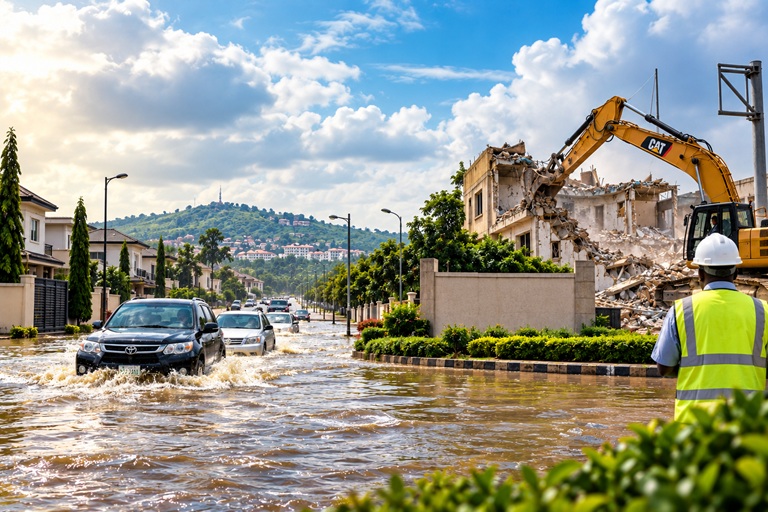
Heavy rainfall in August left several parts of Abuja dealing with serious flooding, with Gwarinpa among the districts affected. Around the same period, the FCT Administration ordered the demolition of about 30 buildings found to be encroaching on the Right of Way of the Ring Road 3 corridor linking Karsana, Gwarinpa and Kubwa.
For residents, businesses and property owners, these developments are more than isolated incidents. They highlight an important question: what happens when a rapidly growing district meets infrastructure that has to catch up with it?
Here is what is happening and what it means if you live in, own property in or are considering buying property around Gwarinpa.
Why Is Gwarinpa Flooding in 2026?
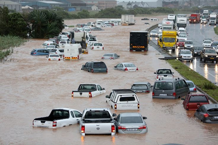
The flooding in Gwarinpa is part of a wider flooding problem affecting several parts of Abuja.
Following heavy rainfall in August 2026, flooding was reported in Gwarinpa as well as Wuse 2, Katampe, Mabushi, Lugbe, Nyanya, Asokoro, Maitama, Utako, Wuye and Gudu. Roads were submerged in several locations, while motorists and residents faced significant disruption.
Heavy rainfall is the immediate trigger, but rainfall alone does not explain why some parts of the city flood more severely than others.
Several factors can increase the risk:
- Blocked or poorly maintained drainage channels
- Construction debris and refuse obstructing waterways
- Development around natural drainage paths
- Increased paved and built-up surfaces
- Inadequate drainage capacity in some locations
- Changes to natural water-flow patterns caused by development
The Federal Ministry of Environment, for example, identified blocked manholes, silt, solid waste and debris as factors that worsened flooding during an August incident in Wuse II. The ministry said restricted drainage reduced the system’s ability to move stormwater efficiently during intense rainfall.
This is important because the same principle applies when assessing property anywhere in Abuja: a property can be in a prestigious district and still have a significant flood risk.
Flood-Prone Areas in Gwarinpa: What Should You Watch?
It is important not to label the entire Gwarinpa district as flood-prone.
The August 2026 flooding affected multiple Abuja districts, and even within a single district, individual streets and properties can experience very different levels of risk depending on elevation, drainage and surrounding development.
Reports have nevertheless identified parts of Gwarinpa among areas affected by the recent flooding.
If you live in or are considering buying property in Gwarinpa, pay particular attention to:
1. Roads and properties where water regularly pools
If residents repeatedly report water accumulating on a particular road after heavy rainfall, that history is worth taking seriously.
One isolated flooding incident does not automatically make an entire neighbourhood unsafe. But repeated flooding is valuable information for anyone assessing a property.
2. Properties below road level
Look at the relationship between the property and the surrounding road.
If the compound sits significantly below the road or surrounding properties, stormwater may naturally flow towards it.
3. Properties close to drainage channels
Drainage infrastructure can be an advantage when properly designed and maintained, but building too close to drainage corridors or natural waterways can create both flooding and regulatory risks.
4. Areas undergoing major construction
Road construction can temporarily alter traffic patterns, drainage routes and accessibility.
This is particularly relevant around areas connected to the Ring Road 3 project.
The key point is simple: don’t judge flood risk by the name of the district alone. Judge the specific property and its immediate environment.
What Happened With the Ring Road 3 Demolitions?
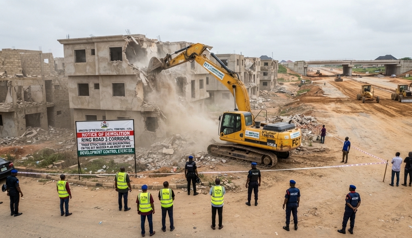
On August 20, 2026, FCT Minister Nyesom Wike ordered the immediate demolition of about 30 buildings located within the Right of Way of the Ring Road 3 corridor.
The directive followed an inspection of ongoing infrastructure projects linking Karsana, Gwarinpa and the Kubwa axis. Officials told the minister that the structures had encroached on the corridor reserved for the road project and associated interchange infrastructure.
The Ring Road 3 corridor connects the Karsana area towards Kubwa Road and the wider road network leading towards the Airport Road axis.
According to reports, construction of a second bridge along the corridor was already underway.
The FCT Administration’s position was that private structures should not obstruct major public infrastructure or undermine the Abuja Master Plan.
By August 24, the Department of Development Control had commenced demolition of the affected structures in Karsana.
Why the Demolitions Matter to Property Buyers
The Ring Road 3 demolitions highlight an issue property buyers sometimes overlook.
A building can have value today and still carry planning risk tomorrow.
When buying property in Abuja, it is not enough to ask:
“Does this property have a title?”
You should also ask:
- What is the approved land use?
- Is the property inside or close to a road Right of Way?
- Is there a planned road expansion around the property?
- Is the property close to a drainage or waterway corridor?
- Are the building approvals valid?
- Does the existing development correspond with the approved plan?
- Could future infrastructure affect the property?
These questions become particularly important in rapidly developing districts where roads and other public infrastructure are being expanded.
Property Risks in Gwarinpa in 2026
For anyone buying or owning property in Gwarinpa, the current situation highlights several risks worth checking.
1. Flood risk
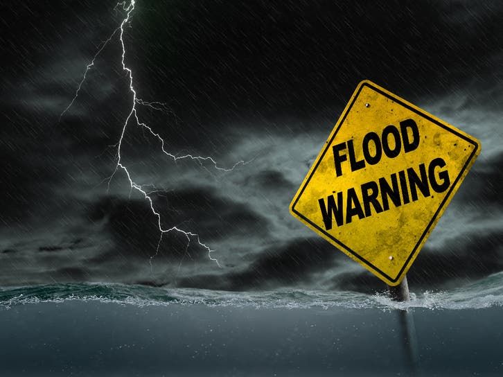
It can also affect access to a property and make a location less attractive to tenants.
But remember: one flood does not automatically mean a property is flood-prone.
The more useful question is whether there is a recurring pattern and what causes the water to accumulate.
2. Right-of-Way risk
The Ring Road 3 demolitions demonstrate why buyers should establish whether a property sits within or near land reserved for future infrastructure.
A buyer should not rely solely on what a seller or agent says about the property.
3. Drainage and waterway risk
A property may look perfectly fine during the dry season and reveal serious problems during heavy rainfall.
Check where water from the property, neighbouring properties and surrounding roads goes.
4. Construction disruption
Major road projects can bring long-term benefits to an area, but construction can temporarily affect traffic, accessibility, noise and business activity.
For commercial property owners, these disruptions can have direct financial consequences.
5. Resale and rental risk
A property with recurring flooding, difficult access or significant planning uncertainty may become harder to rent or resell.
This is why the cheapest property is not always the best investment.
The real cost of a property includes the problems you may have to deal with after buying it.
What Should You Check Before Buying Property in Gwarinpa?
If you are considering buying land, a house, an apartment or commercial property in Gwarinpa, don’t stop at inspecting the building.
Check the property and everything around it.
Before committing your money, investigate:
Flooding
Ask nearby residents what happens when there is heavy rainfall.
Don’t ask only the seller.
Speak to people who live around the property and, if possible, inspect the area during or immediately after significant rainfall.
Drainage
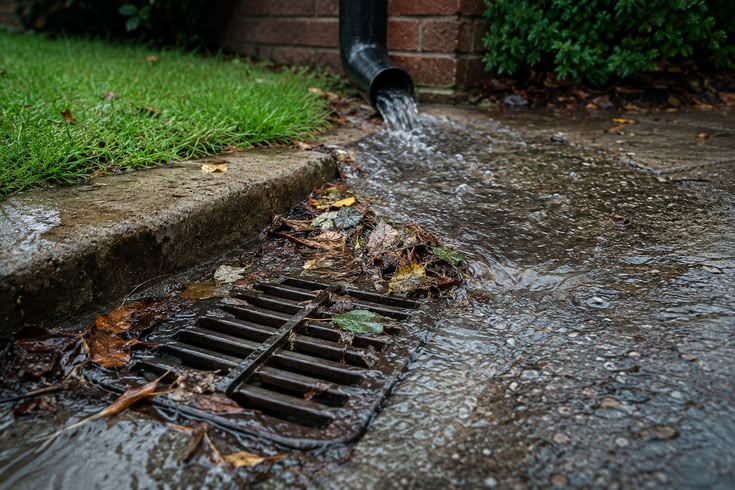
Look at the drains surrounding the property.
Are they properly connected?
Are they blocked?
Where does the water go?
Is the property lower than the surrounding road?
Road infrastructure
Find out whether there are planned roads, bridges, interchanges or road expansions close to the property.
The Ring Road 3 development is a reminder that infrastructure plans can materially affect property.
Title and approvals
Verify the property’s title and ownership history.
Also verify the relevant planning and development approvals rather than assuming that a building standing on a piece of land is automatically compliant.
Right of Way
Confirm that the property does not fall within a designated Right of Way or other land reserved for public infrastructure.
Surrounding development
Don’t inspect only the building.
Look at the roads, neighbouring properties, drainage channels, undeveloped areas and natural water-flow patterns around it.
A good building in a bad location can still be a bad property investment.
What Does the Gwarinpa Flooding and Ring Road 3 Project Mean for the District?
There is another side to this story.
Major infrastructure projects can ultimately improve connectivity and accessibility. A completed Ring Road 3 corridor could make movement between parts of the FCT easier and support further economic activity around the connected districts.
But the transition can be disruptive.
The demolitions have affected properties sitting within the project corridor, while construction can temporarily alter movement and accessibility.
The flooding issue also shows why infrastructure development cannot be treated separately from drainage and urban planning.
Abuja is continuing to grow. More buildings mean more paved surfaces, more traffic and more pressure on roads, drainage and other infrastructure.
If development happens faster than infrastructure planning and maintenance, flooding and congestion become increasingly difficult to manage.
The Bigger Lesson for Abuja Property Buyers
The events in Gwarinpa point to a broader lesson:
Don’t buy Abuja property based on location reputation alone.
Maitama, Asokoro, Wuse, Gwarinpa or any other popular district can contain properties with very different levels of risk.
Two properties on the same street may have different elevations, drainage conditions, documentation or planning restrictions.
A smart property buyer therefore investigates the specific property, not just the district.
And in 2026, flood risk and infrastructure planning deserve to be part of that investigation.
Conclusion: Is Gwarinpa Still a Good Place to Buy Property?
Gwarinpa remains one of Abuja’s established residential districts, but the events of 2026 show why property buyers should look beyond reputation.
The Gwarinpa flooding of 2026, the wider Abuja drainage problems and the Ring Road 3 demolitions all point to the same underlying lesson: Abuja is growing, and infrastructure, planning and property development have to grow with it.
For existing property owners, this is a good time to review your property’s drainage, planning status and proximity to major infrastructure corridors.
For prospective buyers, it is a reminder to carry out proper due diligence before paying for a property.
Don’t ask only, “Is Gwarinpa a good place to buy?”
Ask the more important question:
“Is this particular property safe, properly documented and suitable for the future?”
At MiraEmma Properties, we help property buyers look beyond the building itself and identify potential risks before they commit their money.
Frequently Asked Questions
Why has Gwarinpa been flooding in 2026?
Gwarinpa was among several Abuja districts affected by heavy rainfall and flooding in August 2026. The wider flooding problem has been linked to intense rainfall combined with factors such as blocked drainage, waste, development patterns and pressure on existing stormwater infrastructure.
Which areas of Gwarinpa are most affected by flooding?
Flooding does not affect every part of Gwarinpa equally. Reports have identified Gwarinpa among the Abuja districts affected by the August 2026 flooding, but buyers should assess the specific street and property rather than assuming that the entire district has the same flood risk.
Why did the FCT government demolish buildings along Ring Road 3?
The FCT Administration ordered the demolition of about 30 buildings after officials identified them as encroaching on the Right of Way reserved for the Ring Road 3 corridor and associated infrastructure linking Karsana, Gwarinpa and Kubwa.
Are the Ring Road 3 demolitions happening in Gwarinpa?
The affected corridor connects Karsana, Gwarinpa and the Kubwa axis. Reports on the demolition exercise specifically identified the affected structures as being in the Karsana District along the Ring Road 3 corridor.
Is it safe to buy property in Gwarinpa in 2026?
Gwarinpa remains an established district, but buyers should not rely on the reputation of the district alone. They should investigate the specific property’s flood history, drainage, elevation, title, planning approvals and proximity to roads, waterways and other infrastructure corridors.
What should I check before buying property in Gwarinpa?
Check the property’s title and ownership history, planning approvals, Right of Way status, drainage, elevation, previous flooding, surrounding development and any planned infrastructure that could affect the property.
Does one flood mean a property is unsafe?
No. A single extreme rainfall event does not automatically establish that an entire neighbourhood or property is permanently flood-prone. However, repeated flooding or persistent water accumulation should be treated as an important property-risk signal and investigated before purchase.
What is causing Abuja’s wider flooding problem?
Heavy rainfall is the immediate trigger, but flooding can be worsened by blocked drains, silt, solid waste, development patterns, reduced natural water-absorption areas and drainage infrastructure that cannot adequately handle runoff. Recent government assessments have specifically highlighted blocked drainage infrastructure as a contributing factor.